
Seen from space
Hochatown Growth, 2017 to 2026
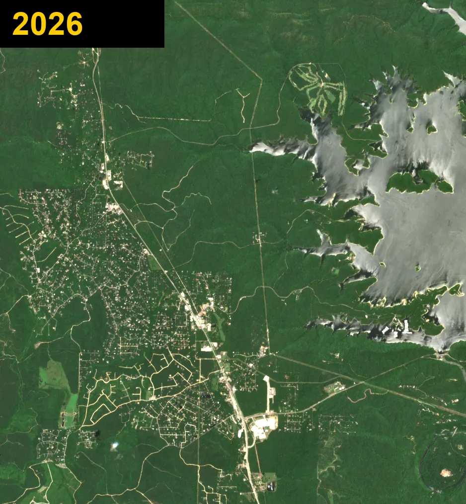
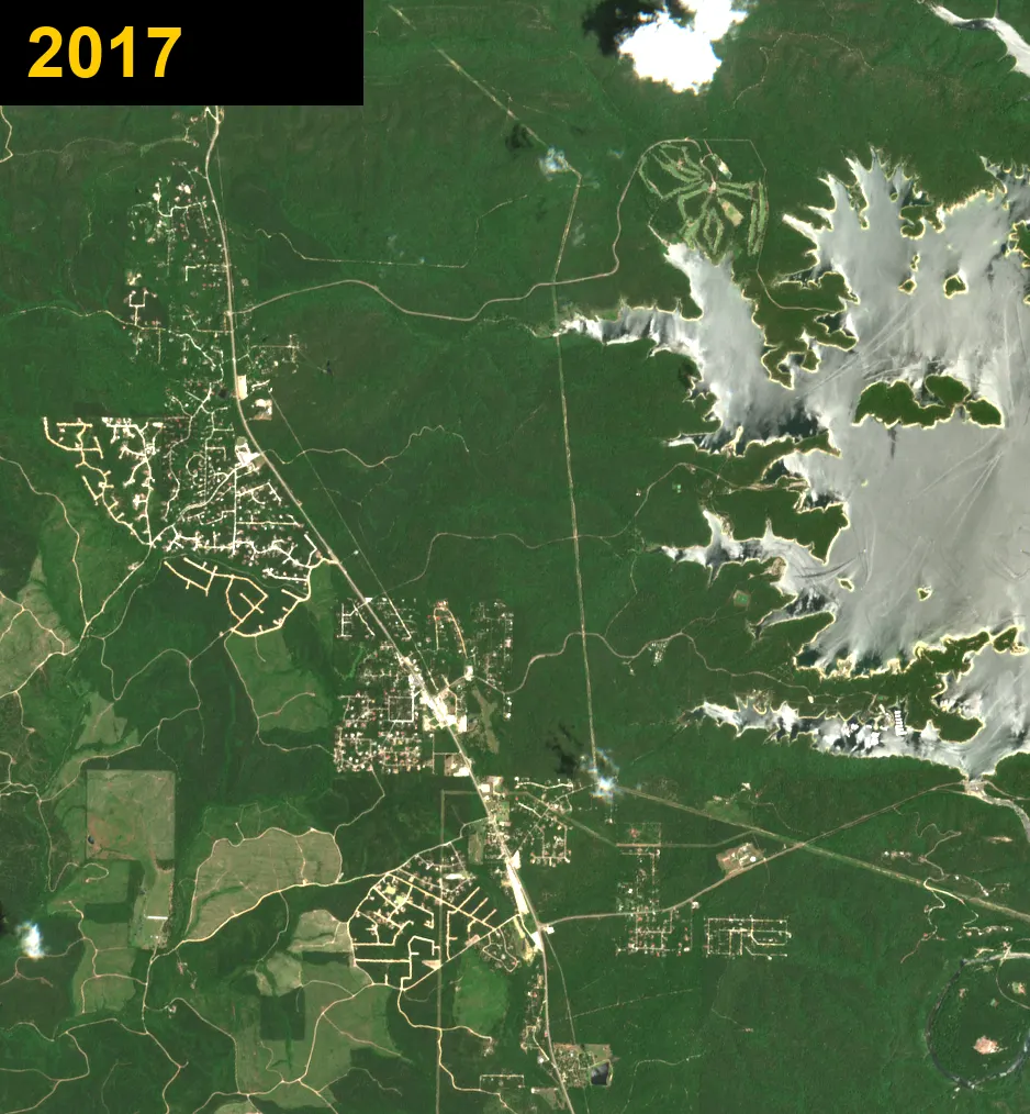
In 2017 most of this was woods. Nine years later, cabin roads cover the hills between the highway and Broken Bow Lake. These are real satellite pictures, one for every year.
Watch Hochatown grow
Every year from 2017 to 2026, one after another.
Then and now
Slide to compare 2017 (left) with 2026 (right).
Pick a year
New land cleared in Hochatown
Every Saturday we compare the newest satellite picture with one from a year earlier. Spots where woods turned to bare ground show up here, circled in red. Cleared land is often the first sign of new cabins, roads or businesses, but the pictures are too blurry to tell what is being built.
Seen October 22, 2026
2 spots, about 3.0 acres in all, compared with a picture from a year before.
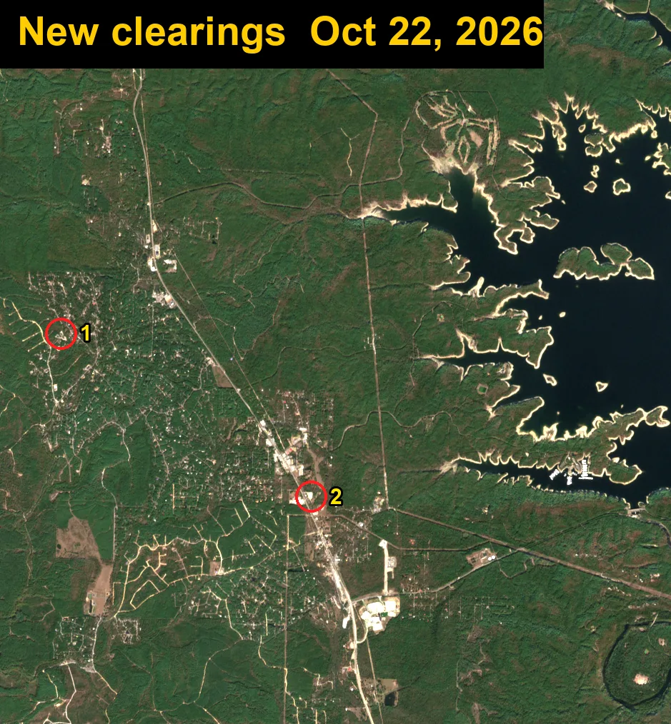
- 1About 1.1 acresSee on map
- 2About 1.9 acresSee on map
How Hochatown grew
US-259 runs top to bottom through the middle. Broken Bow Lake is the big water on the right. The pale lines spreading through the trees are new roads and cabin lots. Most of the new construction since 2017 is cabin neighborhoods west of the highway and new shops along US-259.
Each dot in these pictures is about 30 feet across, so you can see roads and cleared land but not single cabins or cars.
Want to compare? See Broken Bow growth from 2017 to 2026, the older town about 10 miles south.
Contains modified Copernicus Sentinel data 2017–2026 (European Space Agency).