
Poteau • LeFlore County
Where Is the Public Road Up Cavanal Hill in Poteau?
Short answer: the public road to the top of Cavanal Hill is Witteville Road, about 4.5 miles of blacktop from US-59 in Poteau. Coming from the north on US-59, turn right on Hughes Drive, then right on Witteville Road at the next stop sign. After about 1.2 miles you reach a Y; keep left and follow it to the top.
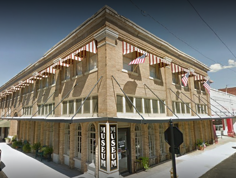
Cavanal Hill road
The short answer
The public way up Cavanal Hill is Witteville Road, a paved road of about 4.5 miles that climbs from Poteau to the top. Rather than a GPS pin, use the directions from TravelOK, the state tourism site. From the north on US-59/271, turn right on Hughes Drive, then turn right on Witteville Road at the next stop sign. In about 1.2 miles you come to a Y in the road; take the left fork and follow it to the top.
From the south on US-59/271, turn left on Smith at the fourth traffic light, then right on Witteville Road and follow it up. The Y is the spot most likely to send you the wrong way, so stay left there.
- Public road: Witteville Road, about 4.5 miles of blacktop
- From the north: US-59/271, right on Hughes Dr, right on Witteville Rd, left at the Y
- From the south: US-59/271, left on Smith at the 4th light, right on Witteville Rd
- At the top: picnic pavilion, the Cavanal Hill rock photo spot and valley views
- Race: Cavanal Killer, every spring, run by the Poteau Chamber of Commerce
🛣️ Getting there
Driving Witteville Road to the top
Witteville Road is blacktop all the way, about 4.5 miles from the bottom to the top, with views over the Poteau River Valley. Much of it follows an old railroad bed, and the Y about halfway up is where the old coal town of Witteville stood. Keep left at the Y to stay on the road to the top.
The upper part has switchbacks and steep grades, so take it slow, especially coming down. If your map app keeps routing you onto a gravel or private drive, turn back to Witteville Road and follow the directions above instead.
⛰️ What's up there
What you'll find on top
At the top there is a picnic pavilion, the Cavanal Hill rock that makes a popular photo spot, and wide views of the valley. On a clear day you can see Mount Magazine in Arkansas, and it is a favorite spot for watching the stars.
The sign at the base calls it the World's Highest Hill at 1,999 feet. The summit's real height above sea level is about 2,385 feet, and its official name is Cavanal Mountain. Pack water and snacks if you plan to use the picnic pavilion.
🏃 Run it
The Cavanal Killer race
Every spring the Poteau Chamber of Commerce holds the Cavanal Killer, a one-way race of about 5 miles from Poteau Primary School on Hughes Drive to the top of the hill, with a shuttle back down. The 2026 race was the 19th and was held on May 9.
📸 More around Poteau
Other lookouts and history nearby
Heavener Runestone Park, just south in Heavener, is a 55-acre park with about two miles of hiking trails and a scenic overlook. Back in downtown Poteau, the LeFlore County Historical Museum in the old Hotel Lowrey has more than 25 rooms of local history.
For a longer drive, the Poteau Chamber of Commerce also points visitors to Lake Wister State Park and the Talimena National Scenic Byway.
 📸 Hiking trails and a scenic overlook · Heavener
Heavener Runestone Park is a 55-acre park built around the Heavener Runestone, a large sandstone slab carved with eight markings.
See hours, photos & directions → 📸 Local history downtown · Poteau
The LeFlore County Historical Museum is a history museum in downtown Poteau, Oklahoma.
See hours, photos & directions →🗺️ Everything on one map
Find it on the map
📅 This week & coming up
Coming up around Poteau
💡 Before you go
Before you head up
Skip the GPS pin
Follow Hughes Drive to Witteville Road instead of a pin on the summit.
Stay left at the Y
The fork about 1.2 miles up is where people take the wrong road.
Go slow coming down
The switchbacks are steep, so use a low gear.
Pack a picnic
There is a pavilion at the top, so bring water and snacks.
Pick a clear day
Clear skies give the best view toward Arkansas.
❓ Good to know
Common questions
Where is the public road up Cavanal Hill?
Witteville Road in Poteau. From US-59/271, turn on Hughes Drive, then onto Witteville Road, and keep left at the Y about 1.2 miles up.
Why did my GPS take me to a private road on Cavanal Hill?
Map apps sometimes route to the summit by a side road. Use the turn-by-turn route from US-59 via Hughes Drive and Witteville Road, and stay left at the Y.
Is the road up Cavanal Hill paved?
Yes. It is about 4.5 miles of blacktop with some steep switchbacks near the top.
What is at the top of Cavanal Hill?
A picnic pavilion, the Cavanal Hill rock photo spot and views over the Poteau River Valley, and toward Mount Magazine on a clear day.
Is Cavanal Hill really the world's highest hill?
That is what the sign at the bottom says, at 1,999 feet. The summit's real height above sea level is about 2,385 feet.
🧭 Keep planning